Log in
All resources
Create a design
323 Free Artworks of 1892 Maps
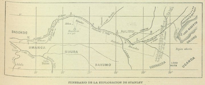
africa in the 1890s
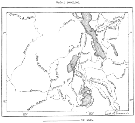
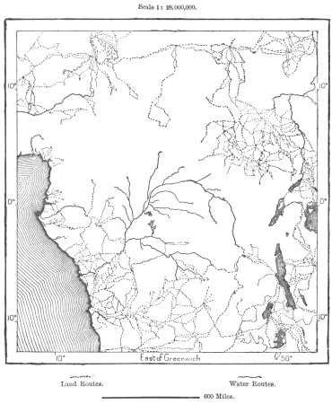
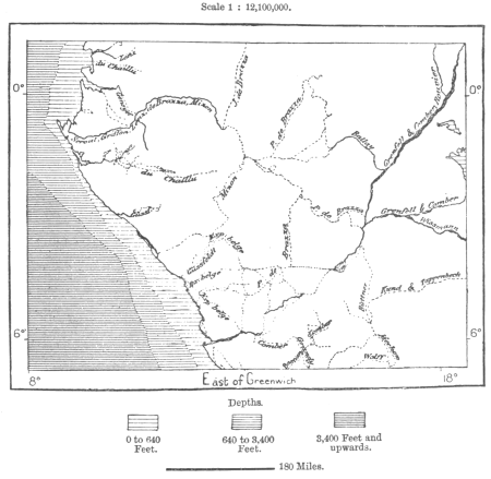
maps from the earth and its inhabitants, vol. xii
maps of africa
geography of africa
a flying trip to the tropics
canary islands in the 1890s
the earth and its inhabitants, vol. xii: africa, vol. iii
from edinburgh to the antarctic. an artist's notes and sketches during the dundee antarctic expedition of 1892-93
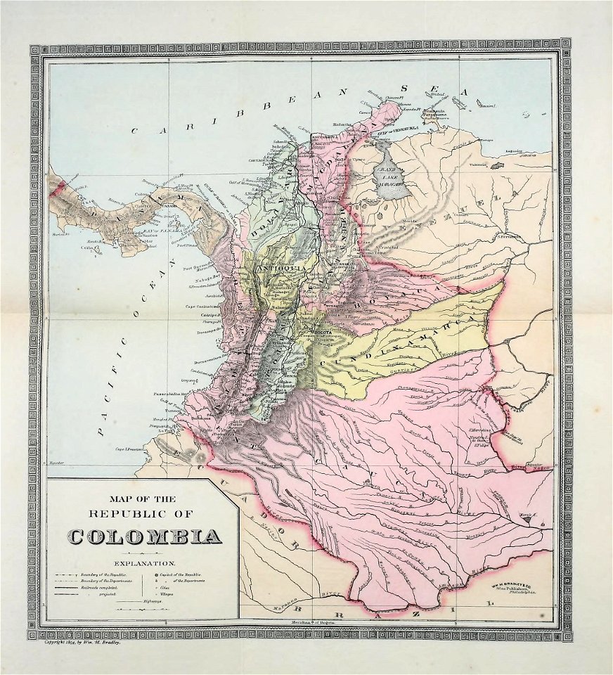
colombia
natural history
maps from the earth and its inhabitants, vol. xii
africa in the 1890s
maps from the earth and its inhabitants, vol. xii
africa in the 1890s
maps from the earth and its inhabitants, vol. xii
africa in the 1890s
africa in the 1890s
maps of africa
maps from the earth and its inhabitants, vol. xii
africa in the 1890s
maps from the earth and its inhabitants, vol. xii
africa in the 1890s
maps from the earth and its inhabitants, vol. xii
africa in the 1890s
maps from the earth and its inhabitants, vol. xii
africa in the 1890s
maps from the earth and its inhabitants, vol. xii
africa in the 1890s
maps from the earth and its inhabitants, vol. xii
africa in the 1890s
maps from the earth and its inhabitants, vol. xii
africa in the 1890s
maps from the earth and its inhabitants, vol. xii
africa in the 1890s
maps from the earth and its inhabitants, vol. xii
africa in the 1890s
maps from the earth and its inhabitants, vol. xii
africa in the 1890s
maps from the earth and its inhabitants, vol. xii
africa in the 1890s
maps from the earth and its inhabitants, vol. xii
africa in the 1890s
maps from the earth and its inhabitants, vol. xii
africa in the 1890s
maps from the earth and its inhabitants, vol. xii
africa in the 1890s
maps from the earth and its inhabitants, vol. xii
africa in the 1890s
maps from the earth and its inhabitants, vol. xii
africa in the 1890s
africa in the 1890s
maps of africa
maps from the earth and its inhabitants, vol. xii
africa in the 1890s
maps from the earth and its inhabitants, vol. xii
africa in the 1890s
maps from the earth and its inhabitants, vol. xii
africa in the 1890s
maps from the earth and its inhabitants, vol. xii
africa in the 1890s
maps from the earth and its inhabitants, vol. xii
africa in the 1890s
maps from the earth and its inhabitants, vol. xii
africa in the 1890s
maps from the earth and its inhabitants, vol. xii
africa in the 1890s
maps from the earth and its inhabitants, vol. xii
africa in the 1890s
maps from the earth and its inhabitants, vol. xii
africa in the 1890s
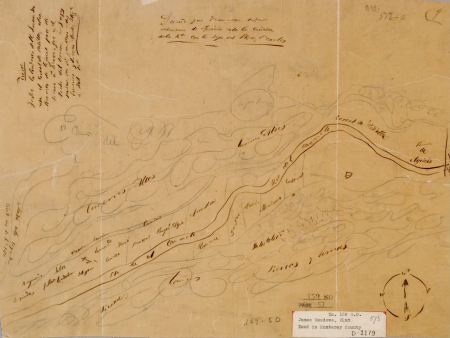
maps of carmel valley, california
james meadows
maps from the earth and its inhabitants, vol. xii
africa in the 1890s
maps from the earth and its inhabitants, vol. xii
africa in the 1890s
maps from the earth and its inhabitants, vol. xii
africa in the 1890s
maps from the earth and its inhabitants, vol. xii
africa in the 1890s
maps from the earth and its inhabitants, vol. xii
africa in the 1890s
maps from the earth and its inhabitants, vol. xii
africa in the 1890s
maps from the earth and its inhabitants, vol. xii
africa in the 1890s
maps from the earth and its inhabitants, vol. xii
africa in the 1890s
maps from the earth and its inhabitants, vol. xii
africa in the 1890s
maps from the earth and its inhabitants, vol. xii
africa in the 1890s
maps from the earth and its inhabitants, vol. xii
africa in the 1890s
maps from the earth and its inhabitants, vol. xii
africa in the 1890s
maps from the earth and its inhabitants, vol. xii
africa in the 1890s
maps from the earth and its inhabitants, vol. xii
africa in the 1890s
maps from the earth and its inhabitants, vol. xii
africa in the 1890s
maps from the earth and its inhabitants, vol. xii
africa in the 1890s
napoleon on saint helena
emmanuel de las cases
maps from the earth and its inhabitants, vol. xii
africa in the 1890s
maps from the earth and its inhabitants, vol. xii
africa in the 1890s
maps from the earth and its inhabitants, vol. xii
africa in the 1890s
africa in the 1890s
maps of africa
maps from the earth and its inhabitants, vol. xii
africa in the 1890s
maps from the earth and its inhabitants, vol. xii
africa in the 1890s
maps from the earth and its inhabitants, vol. xii
africa in the 1890s
maps from the earth and its inhabitants, vol. xii
africa in the 1890s
brazilian paintings in the museu antônio parreiras
pedro ii of brazil and empress teresa cristina
maps from the earth and its inhabitants, vol. xii
africa in the 1890s
maps from the earth and its inhabitants, vol. xii
africa in the 1890s
africa in the 1890s
maps of africa
maps from the earth and its inhabitants, vol. xii
africa in the 1890s
maps from the earth and its inhabitants, vol. xii
africa in the 1890s
nouvelle géographie universelle, vol. xvi
maps of holyoke, massachusetts
guida illustrata di montepiano e sue adiacenze (1892)
books from biblioteca lazzerini di prato
the earth and its inhabitants, vol. xii: africa, vol. iii
canary islands in the 1890s
rivista italiana di numismatica 1892
prints of fano
maps from the earth and its inhabitants, vol. xii
africa in the 1890s
new york and brooklyn, with jersey city and hoboken water front
maps in the library of congress
shober & carqueville lithographing company
baylor university
maps from the earth and its inhabitants, vol. xii
africa in the 1890s
maps from the earth and its inhabitants, vol. xii
africa in the 1890s
maps from the earth and its inhabitants, vol. xii
africa in the 1890s
maps from the earth and its inhabitants, vol. xii
africa in the 1890s
the earth and its inhabitants, vol. xii: africa, vol. iii
africa in the 1890s
maps from the earth and its inhabitants, vol. xii
africa in the 1890s
maps from the earth and its inhabitants, vol. xii
africa in the 1890s
guida illustrata di montepiano e sue adiacenze (1892)
books from biblioteca lazzerini di prato
the earth and its inhabitants, vol. xii: africa, vol. iii
africa in the 1890s
klášter blahoslavené anežky v praze
romantic music
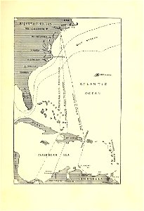
maps of crossings of the atlantic ocean
1890s maps of the atlantic ocean
british new guinea (1892)
ghosts & ghoulish scenes
maps from the earth and its inhabitants, vol. xii
africa in the 1890s
fauna bl - mammalia
wilhelm kuhnert
der ursprung der stadt hadersleben (1892)
maps of haderslev by braun & hogenberg
from edinburgh to the antarctic. an artist's notes and sketches during the dundee antarctic expedition of 1892-93
port stanley, ontario
site plans of leipzig
expressionism
a flying trip to the tropics
1895 maps of south america
from edinburgh to the antarctic. an artist's notes and sketches during the dundee antarctic expedition of 1892-93
old maps of the south orkney islands
illustration
art
colombia
maps
colombia
maps
colombia
maps
a flying trip to the tropics
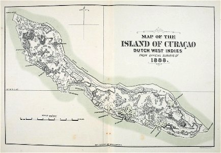
old maps of curaçao
admiralty charts 1801-2000
maps of tawi-tawi
anatomical plates and drawings of the human skull
ghosts & ghoulish scenes - skulls
a flying trip to the tropics
old maps of curaçao
a flying trip to the tropics
1895 maps of south america
währinger straße, vienna
conrad grefe
maps in the rijksmuseum amsterdam
baroque
maps in the rijksmuseum amsterdam
maps by willem and johannes blaeu
201 - 300 of 323
Next page
/ 4